
click features on map for photographs
Estimated Intensities
Yellow boxes indicate average observed EMS Intensity at each location. In general, intensities were found enhanced by one intensity unit on sediments compared to bedrock.
Surface Deformation
No surface rupture has occurred within 1 month of the mainshock. Distributed cracking suggestive of sinistral shear was observed on Hwy2 south of Leogane. The distributed fractures and coral uplift observed in the field is consistent with uplift and shear in the region of maximum strain gradients in interferometric images. Although there is evidence for minor offset interference bands indicative of surface rupture, these are thought to be surficial settlement of less than 10 cm.
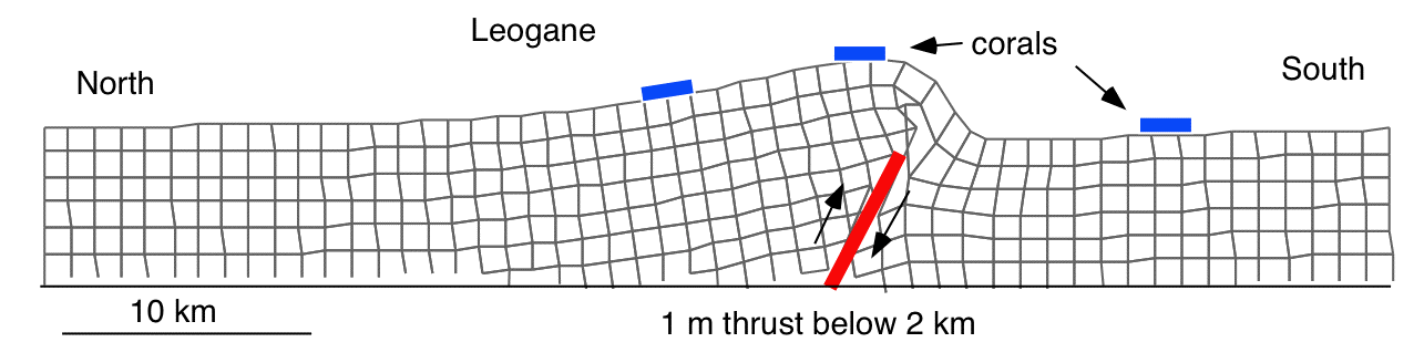
Inferred north-south deformation near Logane using mean 1 m reverse slip on a north dipping rupture below 2 km depth inferred from inversion of PALSAR data by Manabu Hashimoto. The vertical exaggeration of deformation is 100,000, i.e. max uplift in this Coulomb 2.6 model is about 30 cm.

The Interferogram above was provided byEric Fielding28 Jan 2010.